


Lock 33 - Rochester
Day 2
3:00 pm
Total Hrs: 12
Avg. Speed: 8
GPS:
43.096538
-77.570983

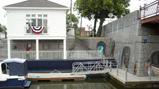
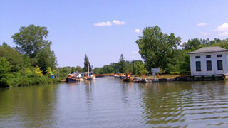
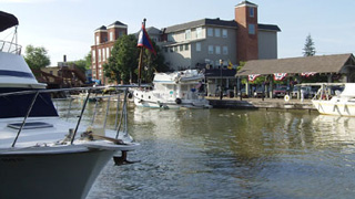
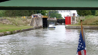
Lock 33 is a welcome sight after a 2.5 hour haul!
For eastbounders, the canal experience has changed. The canal is no longer a man-made waterway that was carved through the landscape. It now flows along on improved natural waterways.
The lock is also the last line of defense between the Genesee River and the protected part of the canal. There is quite a bit of floating debris near the lock entrance.
The lock operator will want to see your pass, so keep it handy. We kept ours in the corner of


the window, but I also snapped a photo of it on the cell phone.
At 90 seconds, the video is time-compressed. Actual time from the approach to leaving the lock was about 20 minutes.


Fishin' at Lock 33
Day 2
3:20 pm
Total Hrs: 12.3
Avg. Speed: Idle
GPS:
43.096538
-77.570983
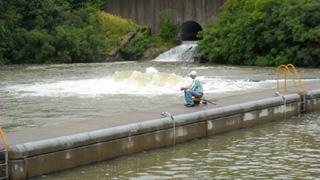
Is the Loch Ness Monster about to emerge from that swell?!? (Or maybe "Champ", The Lake Champlain Monster?)
We're just below the lock. The turbulence is caused by the underwater discharge outlet that empties the lock. The exposed pipe in the abutment above is the drain for the spillway that allows the canal's pool level to be controlled.
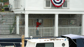
I wouldn't have thought about fishing in that turbulence, but the fisherman in the photo said he was having a good day.
All kidding aside, the canal is a thriving, robust fishery. During our cruise we saw hundreds of people on the banks and in boats, and everyone we talked to reported limit catches. Bass, pickerel, walleye, and panfish are plentiful.
We know that some of the best bass fishing in the state is at the north end of Cayuga Lake, which, along with just being on the boat, is one of our destinations. And where is our fishing gear? In the garage at the house, of course -- exactly where we left it instead of packing it in the car.

Lock 32
Day 2
3:30 pm
Total Hrs: 12.5
Avg. Speed: 8
GPS:
43.091095
-77.544168
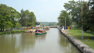
Locks 33 and 32 are nearly identical. We had to wait a few minutes for the upbounders to exit, which gave us just enough time to stop at the wall for a quick doggie walk.
The lock operator asked how far we planned to go today. We said we were planning to overnight at Fairport. A few minutes later she told us she called ahead and Fairport was full. We said we'd keep an eye out for an alternate stop along the way and contact the Fairport Bridge when we got within radio range.
On the way back we had our longest wait on the system -- nearly 25 minutes -- for an upbounder to clear the chamber so it could be drained and ready for us. The upbounder turned out to be Diguise, the boat that couldn't wait. (More later.)

Pittsford
Day 2
3:50 pm
Total Hrs: 12.8
Avg. Speed: 6
GPS:
43.092201
-77.513820
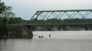
I don't have any pictures of it, but the fixed bridge that limits the travel between Albany and Buffalo on the Canal is just west of Pittsford. It's a train bridge, and the clearance is listed at 15.5 feet. We cleared it by just a few inches with our air draft of 14.3.
Boaters have told stories about filling the bilge or dinghy with water to lower their boats, but the best one I've heard was from Tranquility, who reported that the lock operators lowered the pool of the entire canal between locks 32 and 30 (there is no lock 31) so she could pass under the bridge. It took only minutes to drain that part of the canal, and only minutes to refill it!
We didn't stop at Pittsford, but it sure looked inviting. I'm told they added power & water a few days after we finished our trip. It wasn't an option for an overnight because we didn't want to tax the batteries. We were going to push on
to see if Fairport was indeed full for the night.
Notice the average speed has changed. This section of the canal is populated with private docks that hold mostly pontoon boats. The speed limit is still 10 mph, but we slowed as a courtesy to these boat owners. After all, I would want them to do the same for me.

Bushnell's Basin - Perinton Township
Day 2
4:15 pm
Total Hrs: 13.25
Avg. Speed: 6
GPS:
43.062706
-77.478073
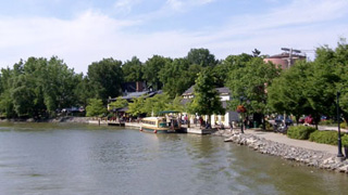
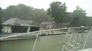
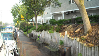
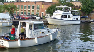
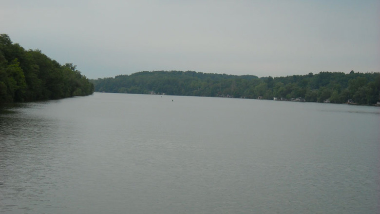
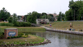
Newly opened this season, Bushnell's Basin is our fallback if Fairport is full. It's within walking distance of several stores and restaurants, and the facilities are beautiful.
The photo was taken from the saloon helm during the return trip. It rained on & off that day -- sometimes in buckets -- and I alternated between the flybridge and saloon.

Fairport
END OF DAY 2
5:00 pm
Total Hrs: 14
Avg. Speed: 6
GPS:
43.101001
-77.440289
As we approached the lift bridge from the west we saw an opening on the north wall before the bridge. It was better than the prospect of a 45-minute jaunt back to Bushnell's, so it became our new fallback. We preferred to be east of the bridge on the south wall. The facilities are on that side, and there's a nice grassy knoll on which Fender T. Dog could take aim and let loose.
I remember the VHF call to the bridge operator:
- Me: "Fairport lift bridge, this is No Losses ..."
- Him: "No Losses, this is the Fairport Lift Bridge. Go ahead, Captain."
- Me: "Is there any space on the wall east of the bridge? I was told you were full for the night."
- Him: "You're in luck, Captain. Several boats left about fifteen minutes ago and there is plenty of space on the north side."
- Me: "Excellent! We'll request passage under the bridge, someone to wash and wax the boat, catering for three hundred people, and a marching band to greet us."
- Him (laughing): "Roger that, Captain. I'll see what I can do. In the meantime I'll have that bridge up for you in just a couple of minutes."
And so he did. The space we grabbed was closest to the bridge on the north wall. Mia didn't really want to stay here because of the noise.
The 100 year-old bridge is an engineering marvel, but it announces its every move with loud warning bells and the squeaks and groans of age. The sump on the north side leaks, so the large, loud pump turns on every couple of minutes and spews a waterfall into the canal through its three-inch pipe. The steel deck amplifies the sound of every car and truck, and this is a very busy street. There are also hinged metal plates that protect the deck. They clang twice with each car or truck that crosses.
Mia pointed out a 20-foot cuddy that was taking up 40 feet of frontage on the south wall. She said it looked like the boat was only there to pick up passengers. The captain of that vessel had started his engine and was receiving guests. As he pulled away from the wall we turned and headed toward his vacated space.
The lines were soon secured, and Mia connected power as I took Fender T. Dog for his overdue walk. He seemed to remember the way to the grassy knoll from our 2010 trip, and he beelined for relief.
I won't attempt to list all of the services and amenities that are available at Fairport Landing. Specialty shops are everywhere. People are friendly. A band played at the gazebo on the north side.
Boaters with dogs are welcome at the wonderful canalside eatery on the north towpath, east of the bridge (about one hundred yards past the boat launch). The owners keep a large ceramic bowl filled with water right next to the towpath for thirsty dogs. It was over 90 degrees at noon on the day we visited. Without being asked, the waitress brought Fender T. Dog a dish of complimentary ice chips. He thanked her with a $2 tip under his dish.
The ice cream shop is a hugely popular destination.
You may be tempted to eat at the Tex-Mex joint on the north side. The margaritas were good, but the plates and silverware were dirty, the food was bland, and it was seriously overpriced.
Speaking of margaritas, Mia and I made a good dent in the pre-made bucket of the frozen concoction that resided in No Losses' freezer.
The walkways next to the walls in Fairport are main thoroughfares for locals and tourists. We love to sit on the aft deck and people-watch.
A balding, harried-looking man walked past us with a purpose. Two steps behind, as if by design or command, his wife followed. To say that she was not attractive would be generous and polite.
Now, Mia and I never won any beauty contests. But at least we don't break mirrors and cameras.
The margaritas were obviously clouding our judgment: Mia and I looked at each other and giggled. I said, "She was only walking two steps back. If that was my wife I'd make her walk a half-block back. She's a halfa-blocker."
Our giggles escalated into laughs. Mia said, "Can you imagine waking up with her next to you on a boat? No place to hide!"
I said I'd make her ride in the dinghy at the end of a 200-foot tow rope. I'd have her pretend she was driving the dinghy. If someone saw me I would yell, "Call the police! She's chasing me!"


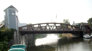
The World-Famous Fairport Lift Bridge
7:30 pm
The Fairport lift bridge is an engineering marvel. It is either in the Guinness Book of Records, or it's a result of drinking too much Guinness. Either way, it was built by the Lackawanna Bridge Company of Buffalo, New York in 1914.
The angles make this bridge unique. The roadbed is on a 32-degree angle, and each of the four corners is a different height. The bridge is also not square. None of the four corners have the same angle. Yet, the bridge lifts straight up, keeping the same angles in the raised position as it does when it's at grade.
The abutments house the cable pulley system, 40hp electric motor, and counterweights. Because much of it is below the waterline there are also powerful sump pumps that return canal water to its rightful home.
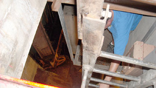
I made it a point to walk up to the control house and shake hands with the operator, Bob. He showed us how the bridge is operated, but wouldn't let me take photos. Although there is a computer in the control room it isn't used to control the bridge. It's used for communication with other operators and keeping track of boat traffic on the canal system.
The controls are large levers mounted on an angled desk. Indicator lights glow to show the status of the bridge and crossing gates. The bridge is operated manually.
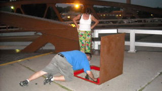
Bob asked if we wanted to see the inner workings of the bridge. We walked down to the roadway level and he popped open a door in the sidewalk. He allowed us to peek inside, but wouldn't let us climb down. I tried begging, but I understood his refusal. He would lose his job if I slipped and fell.


Fairport - Morning of Day 3
9:45 am
Total Hrs: 14
Avg. Speed: 6
Temp. 78
Mostly Cloudy
Winds SW < 10
GPS:
43.101001
-77.440289
Since we were about to push on into heretofore unexplored territory we considered this to be the real first day of our vacation. The pace would be slower and more relaxed, if such a thing was possible.
I again woke up before Mia and took Fender T. Dog for his contitutional. When Fender and I returned Mia presented me with a cup of weak coffee and said, "This is the last of it."
With urgency, I thought:" What about tomorrow morning?!?!" Then I remembered we were living life at 7 miles per hour: "No problem. We'll keep an eye out for a supermarket within walking distance."
We took turns visiting the facilities. Me for a military Triple-S, and Mia for ... whatever ladies do behind closed doors. (I have a feeling it's
the same thing, but none will admit to a Triple-S.)
While she was gone I went through the engine and systems checklist, ran the blower, and warmed the engines. We were under way at 9:45, excited about the new sights we would see around every corner.

Wayneport
Day 3
10:20 am
Total Hrs: 14.6
Avg. Speed: 5
No Wake Zone
GPS:
43.075112
-77.362450
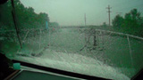
It's sprinkling now with the approaching clouds promising heavier rains, so I covered the flybridge and moved to the saloon.
The flybridge has an unobstructed 360° view. The saloon helm requires more focus and concentration. Worse, I had never operated the boat from the lower helm for more than a minute or two to make sure everything worked.
Below, I can't see aft unless I duck my head and look through the bottom of the rail cover. Front, port, and starboard views are interrupted by stanchions, window treatments, screens, a column, and a steady drip in my sightline from the flybridge.
I was proud of myself for noticing at the end of last season that the windshield wipers needed to be replaced. I was filthy proud of myself for remembering to replace them before this trip!
PS: It also rained here on the return trip. A steady downpour.
PPS: It's a bit disconcerting to find out that the Wayneport Road bridge has had its weight rating downgraded to just 16 tons. That's usually a sign that it's about to fall in the water. Not only that, but the next bridge in Macedon at Canandaigua Road has been deemed unsafe and closed to all traffic!


The Near Miss!
GPS:
43.086112
-77.398467
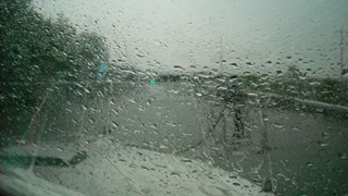
On the return trip, we were enjoying a nice relaxing cruise through a section of narrow rip-rapped channel between Wayneport and Fairport. It was pouring rain, but we were comfy-cozy and dry in the saloon.
A boat has the same mechanical, electrical, plumbing, and HVAC systems as a house. In our case, the boat also has twin 350 GM engines and propulsion systems. One thing you can count on during a long trip: Something will fail.
With no notice, the port engine decided to quit. Anyone who has a boat with twin screws knows that operating on one engine is a challenge. The drag from the port prop combined with the thrust from the starboard screw turned us to port, and the rudders had to be swung nearly hard a-starboard just to keep us in a straight line.
A quick look-see and sniff in the engine compartment revealed no leaks or gasoline vapors. I tried to restart, but the engine would have none of that. I throttled-down on the starboard and figured we'd limp to Fairport where I could make some repairs. Throttling down meant even less control, but I didn't want to spin the feathered port prop too fast for fear of damaging its transmission.
Although system failures can be expected, what happened next proves the adage, "When it rains, it pours!"
With severly limited control, I was fighting the rudder and the approaching storm's wind to keep the boat in the center of the channel. As we approached a bridge, which narrowed the channel even more, a huge service barge and tug came around the turn! The tow was bearing down on us -- consuming almost the entire channel -- and No Losses was squarely in the middle of it!
I heard the tug's horn sound a series of short blasts. The warning signal. There was no stopping the tow in time, and it was running the full ten miles per hour.
No Losses' rudder was already hard a-starboard, and she wouldn't come around to turn towards the bank! I shifted into reverse and gunned it. She came about with her bow
aimed toward the rip-rap. I shifted to forward and gunned it again. Her bow turned to port, but we managed to get a little closer to shore. Three more shifts & guns got her far enough to the side of the channel so we were out of danger, but it was a close one! As the tow passed, the captain screamed nasty things.
But we weren't out of the woods just yet. No Losses' starboard side was now dangerously close to the rip-rap, and her only working engine was in danger of having its prop damaged by the rocks. Worse, the three-foot wake from the tow was fast approaching!
I threw the engine into reverse and gunned it. The bow nearly hit the rocks, but she came about and started inching back into the center of the channel. That's when the wake hit, sending us back toward the rocks!
It all happened over the course of maybe one minute, but it felt like an hour. After I settled down, I called the Fairport bridge operator, told him what happened, and asked him to call the captain of the tow to offer my explanation and apologies. He did exactly that.
Strangely enough, a second attempt to start the port engine fifteen minutes later was successful. It gave us problems several more times on the return trip, but continued to run until we got home.
Needless to say, I didn't get any pix or video of this near-miss. I was a little busy with other things.

Lock 30 - Macedon
Day 3
10:45 am
Total Hrs: 15
Avg. Speed: 8
GPS:
43.073814
-77.303664
Everyone who buys a Canal System pass receives a little booklet with maps that show lift bridges, locks, and guard gates. The map of this area is particularly confusing because it shows a lift bridge at Macedon. The lift bridge is actually located at Fairport, and Lock 30 is in Macedon.
In fact, the Fairport lift bridge is the last of the quaint bridges you'll have to pass eastbound. From here on, it's locks. Lots of locks.
Macedon is home to the preserved ruins of the original canal's Lock 60, about a mile east of the village on the north side of the canal. There is a small dock there. I'm kicking myself for not getting photos.
At 110 by 18 feet, the original locks don't seem large enough to have carried all of the traffic and cargo that passed. But they only had to accommodate boats that were 60 feet long with a 7-foot beam and a 3.5-foot draft. In fact, the original canal was only 40 feet wide and four feet deep!
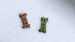
The (modern) lock operator took a liking to Fender T. Dog and gave him two treats. For some silly reason I did take a blurry photo of the treats. Maybe I need to rethink my priorities? But in my way of thinking: Lock 60 will be there for future photo ops. The treats were gone in seconds.


Palmyra
Day 3
11:30 am
Total Hrs: 15.75
Avg. Speed: 8
GPS:
43.067204
-77.228754
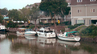
Six minutes after locking through at Lock 29 we saw a beautiful little harbor at Palmyra. Palmyra claims to be the birthplace of the Mormon Church. We didn't visit any of the tourist offerings. We did, however, mark it on the GPS for an overnight stop on the return trip, which is exactly what we did.
Depth is a consistent 7 feet in the harbor with ample power and water. The facilities are up the hill in a pavilion, and they are very nice. The town is a five-minute walk and has a Family Dollar, a liquor store, and a couple of restaurants. In typical small-town fashion, they roll up the sidewalks very early.
The "Muddy Waters" eatery is the building at the top of the ramp. It looked like it could be a good breakfast joint. It wasn't open in the evening, and we left the next morning before it opened so we couldn't sample their wares.
When we arrived at 6:15 pm on the return trip we tied off behind Disguise. Guy, the Captain, told us he'd been exploring the canal system for years. When we met he was on his way home
to Rochester, one day from wrapping a three-month trip. The next morning we told him we were getting ready to leave, and since we were going in the same direction we could avoid delays at the locks if we traveled together. He wanted none of that, and we wound up waiting for him twice. I understood. He's a loaner and uses the canal to live his own version of the Great American Escape Fantasy.

Newark
Day 3
12:30 pm
Total Hrs: 16.75
Avg. Speed: 8
GPS:
43.047433
-77.093355
Lightning and thunder accompanied us for the next stretch, but the storm didn't hit us. A light rain moved me to the saloon helm for 20 minutes, but I was soon back on the flybridge.
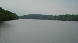
At noon we passed the Wide Waters of Port Gibson, but we couldn't see a port. In fact, we could see very little signs of civilization except for the occasional pontoon at a private dock.
We decided to stop at Newark for lunch. The south wall has both low floating docks and a concrete wall that was the perfect height for No Losses. No power or water on that side, however. The much higher north wall has the facilities, and there is a section of floating docks as well. We forgot all about walking to a store (100 yards away!) for tomorrow morning's coffee.
Ummm ... Mia noticed that the same couple who walked past us in Fairport (harried man/ugly woman) were walking along the north wall. He had gotten wise: She was now walking three steps behind him! I looked, but didn't see a dinghy.
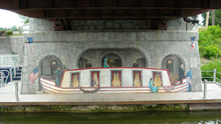
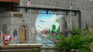
One of the most interesting highlights of this stop is the mural work under the Veteran's Bridge. It depicts life on the canal in 1825, and at a glance you'd think the people were real. The mural winds its way from one side of the bridge abutment to the building next to the bridge. All of the blocks on the walls are painted, and you have to get very close to realize that the stairway is real!
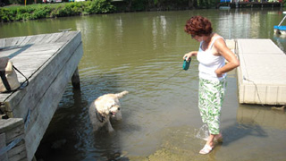
We spent an hour here relaxing. Fender T. Dog stretched his legs and investigated foreign aromas that only he could smell.
The video wraps up this section of the canal. One of the shots is a dam that shows how the waterway's pool depth is controlled. The pool was high because of the rain.